Our Services Include
-Commercial and Residential Land Surveys-Engineering Surveys
-ALTA/ACSM Type Surveys
-Topographic Surveys
-As-Built or Record Surveys
-Land Boundary Surveys
-FEMA Elevation Certificates
-Utility Locating and Mapping
-Construction Layout & Site Plans
-Subdivision Recording, Zoning, and Permitting
-GPS/GNSS Geodetic Control Surveys
-Geomatics Services | Gemoatics Engineering
Our staff of Surveyors are professionally licensed in the states of
South Carolina, North Carolina, Georgia, Florida, and Alabama
which provides our clients with a single contact for multi-state projects.
Commercial and Residential Land Surveys
We perform Land Surveys for both residential and commercial properties.
We also perform Subdivisions for residential and commercial properties dividing
real property into two or more parcels, tracts, or lots. We perform the entire
subdivision process from the initial boundary survey and preliminary subdivision design
to final municipal approval. Arrow North Surveying will take your project through the
entire subdivision process.
Subdivision Design may include:
Lot Design and Master Planning
Road and Sidewalk Design
Grading Plans
Soil Erosion & Sedimentation Control Plans
Storm Drainage System Design
Detention Pond Design
Sanitary Sewer Design
Permitting and Construction Administration
***not available in all practicing states***
Engineering Surveys for design projects
Arrow North Surveying, LLC specializes in offering land surveying services for
engineering design firms that do not offer Professional Surveying services
in house. Our regional licensing allows Arrow North Surveying, LLC the ability to work
in several states providing our clients with a single contact for multi-state projects.
*If you need a design engineer we have several proven engineers
we work with. We will put you in touch with one or several depending on your
needs, as a courtesy click here if you need a
Professional Engineer
ALTA / ACSM Surveys
A survey of real property (usually commercial) which meets or exceeds the standards adopted by ALTA(the American Land Title Association) and the NSPS (National Society of Professional Surveyors) for A.L.T.A surveys. The most current standards can be found by clicking here.
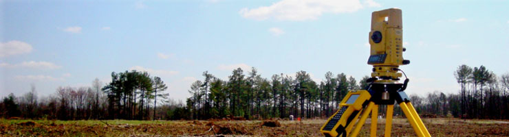
Topographic Surveys
A survey of the natural and selected man-made features of a part of the earth's surface by ground measurements to determine horizontal and vertical spatial relations.
As-built Surveys
A boundary survey showing the location of all existing structures, improvements, fences, etc. and showing any encroachments in relationship to boundary lines.
Land Boundary Surveys
A survey, the primary purpose of which may include, but is not limited to, the determining of the perimeters of a parcel or tract of land by establishing or reestablishing corners, monuments, and boundary lines for the purpose of describing, or platting or dividing the parcel.
FEMA Elevation Certificates
A FEMA Elevation Certificate is a requirement of the National Flood Insurance Program for the determination of flood insurance rates. We obtain the necessary data and complete certificate. The most current certificate can be found by clicking here.
Utility Locating and Mapping
We provide locating and mapping services for private underground utilities (Gas, Water, Fiber Optic, Telephone, and TV)that 811 will not mark on private property. The mapping and paint marking locations of underground utilities we provide should be considered approximate, if exact locations are necessary excavation is required.
Site Plans
A drawing of your property showing the boundary lines and structures that currently exist on the property, and the proposed location of your new structures or features.
Construction Stakeout / Construction Layout
The staking of points horizontally and/or vertically for construction from plans or electronic drawings provided by design professionals. We can stake for clearing, silt fence, tree protection, ponds, utilities, roads, pilings, buildings, or any other construction needs.
Subdivision Recording, Zoning, and Permitting
Arrow North Surveying will take your subdivision through the
local land division and recording stages of development. We obtain all necessary
information for recording of the subdivision plats. Our Re-Zoning service is for a
property owner who would like to re-zone an existing parcel of record for a
different land use. We take the hassle out of your Zoning, Permitting, and Due
Diligence needs.
Geomatics Services | Gemoatics Engineering
Geomatics or "Geomatics Engineering" is a relativity new term incorporating many
different roles of the professional land surveyor in today's technology driven world.
Following the advanced developments in digital data processing, the nature of the tasks
required of surveyor has evolved and the term surveying alone does not any
more describe the whole range of tasks that the profession deals with anymore. As our
societies become more complex, information with a spatial position associated
with it becomes more critical to decision-making, both from a personal and a
business perspective, and also from a community and a large-scale governmental
viewpoint. Therefore, the Geomatics Surveyor/Geomatice Engineer can be involved in an extremely wide
variety of information gathering activities and applications. Geomatics professionals
design, develop, and operate systems for collecting and analyzing spatial
information about the land, the oceans, natural resources, and man made features on and below the earth.
Geomatics engineering applications include integrating science and technology
from both new and traditional disciplines of:
* Geodesy, also called geodetic science
* Cartography, computer and digital mapping
* Remote sensing, photogrammetry (photogrammetric mapping)
* Land information systems (LIS)
* Geospatial information systems (GIS)
* Real Property boundary determination
* Hydrography, navigation, topographic and spatial computing
* Surveying (including land, cadastral, aerial,and engineering surveying)
* Construction layout, route design
* Image understanding and computer aided visualization
* Computer-aided design (CAD)
* Applications programming
* Hydrology, fluid mechanics, and site layout
* Stormwater system design
* Soil Erosion & Sedimentation Control
* Road and sidewalk design
* Project management
CLICK HERE for
the current SC Minimum Standards
CLICK HERE for the current NC Minimum Standards
CLICK HERE for the current GA Minimum Standards
CLICK HERE for a Free Quote for YOUR next project.